|
|
|
 |
|
|
|
|
|
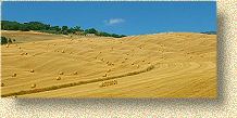
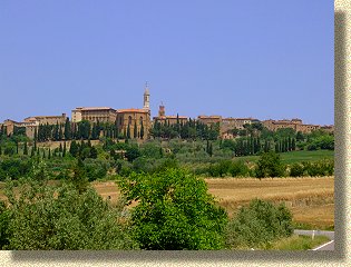
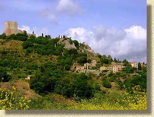
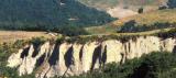
The Orcia Valley
|
![]()
![]()
|
The Orcia
Valley is a land far from the noisiness and the uproar of modern
life, happily remote from the highways and big road junctions. The
unsuccessful industrial developement of the area and the never ending
link betwen the inhabitants and the traditional arts and crafts of the
past have safeguarded the man - environment relationship, raising it
to a dignity hardly known elsewhere. The Orcia
Valley is not only a geographical area naturally privileged by its
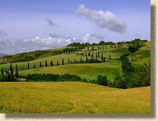
The inhabitants
of the land constantly pursued a vital relationship with nature in the
past, a relantionship which was sometimes consciously strong ,
sometimes unconsciously sweet. The signs left by this enables us to
understand the past by looking at the landscape of to day, drawing us
nearer to those ancient visions which charmed painters, artists and
travellers. The vegetation,
which thickens on the hilltops and encloses streans in a desperate
siege, creates unforseeable depths and ideograms; it then shapes
fluiting barriers, rhythmic signals and cornices with its sudden
presence. Upwards, where
the hilly line breaks down on the suddenly hard and sharp profiles of
the fortresses,
the vegetation thickens to tin out again in the soft lines of the
vineyards and orchards. Morpholo To mark the landscape, east of
Mount Amiata, are two rivers, not particularly famous but On the other side of the
mountain, past the railway station of Mount Amiata and the winding
road leading up to St. Antimo and Montalcino, the landscape
becomes more characteristic of the “Maremma”, as far as the river
flows into the River Ombrone. The course of the Paglia is
shorter: it rises in the confluence of several streams running between
Radicofani and Abbadia San Salvatore, flows southwards
to the old boundary between the Popedome and Graunduchy of Tuscany,
and then bends eastwards among the thick woods of the Natural Reserves
of Mount Rufeno (Latium) and Mt. Meana (Umbria). It runs at last into
a wider valley and after bordering the steely Orvietan Rock, it flows
into the River Tiber. Between the Spas, hot springs, smoke-holes
complete the landscape to show the volcano is alive. The hot waters and the vapours of
Mount Amiata give the landscape of this side of the mountain a
surprising and somewhat Dantesque atmosphere. The Via Cassia, one of the most
beautiful and varied roads in Italy and all over the world, takes the
traveller to the areas east of Mount Amiata. Built about 220 B.C. as a sign of
reconciliation and control over the Etruria conquered by Rome,
the Via Cassia links Rome to Florence, (and to Fiesole in the past)
going through the hills of Nepi, Sutri, Viterbo and the great plain of
Tuscia, the shores of Lake Bolsena, Siena and the s Almost coinciding with the old Via Cassia was the
lay-out of the via Francigena, one the medieval Pilgrim routes
to Rome. The route, of which an accurate description dating bach to
994 A.D. by the Archbishop of Canterbury, Siberis is Kept intact,
climbed over the Alps at the Great San Bernard Pass, arrived in Paris
and crossed the Appennines, descending to Pontremoli and Lucca . The
route then skimmed Florence, heading south to Siena. After Mount
Amiata, it sloped upwards to Radicofani, skirted around Lake
Bolsena, went on towards Rome through Montefiascone, Viterbo and
Sutri. |
Hotel - Farm Holidays - Restaurants - Spa - Itineraries
Events - Typical Products - Culture - Lodgings Rooms
Real Estate - Dimore di Campagna
![]()